Artificial intelligence is the perception, prediction, and decision-making layer of an autonomous vehicle. It turns camera, lidar, radar, and other sensor data into estimates of what is around the vehicle, where those objects are moving, what they may do next, and which driving maneuver is most appropriate. The vehicle then uses planning, control software, safety monitors, and redundant hardware to turn that decision into steering, braking, and acceleration.
AI is essential, but it is not the whole autonomous vehicle. A deployable system also needs localization, maps, vehicle-dynamics control, fault detection, redundant braking and steering, cybersecurity, human-machine interfaces, remote assistance, fleet operations, testing, and a documented safety case. The most accurate summary is: AI makes autonomous driving adaptable and perceptive; systems engineering makes it controllable, fail-safe, testable, and deployable.


That distinction explains the current market. Consumer vehicles sold in the United States remain primarily Level 0–2 driver-assistance systems, whose drivers must supervise the road. Commercial, geofenced Level 4 services can operate without a takeover-ready driver, but only inside a defined operational design domain. Waymo says its fully autonomous ride-hailing service operated in more than 10 cities by July 2026, and Aurora said in July 2026 that its second-generation driverless trucks were operating without a person behind the wheel on public roads. Those are company-reported deployment claims, not evidence that every autonomous vehicle—or any privately owned car—can drive anywhere without supervision. NHTSA’s current safety overview, Tesla’s FSD documentation, Waymo’s July 2026 update, and Aurora’s July 22, 2026 update describe these distinctions and claims.
What artificial intelligence does in an autonomous vehicle
In practical terms, AI helps a vehicle answer five questions continuously:
#1 Best Overall
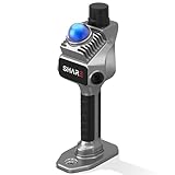
- 1cm High-Precision & 70m Long-Range Scanning: Engineered for demanding terrain and architectural surveying. Equipped with dual 1-inch large-area CMOS sensors delivering 16MP resolution per lens (2.4μm pixel size). It reliably captures spatial data from 0.1 to 40 meters (@ 10% reflectivity) and up to 70 meters (@ 80% reflectivity) for highly accurate 3D mapping.
- 360° LiDAR FOV & Distortion-Free Modeling: Rapidly scan large-area indoor and outdoor spaces in minutes with an expansive 360° × 59° field of view. The built-in mechanical shutter effectively eliminates motion distortion (rolling shutter effect), while dual 16MP ultra-wide cameras (32MP combined) ensure flawless close-range photogrammetry and precise object modeling.
- True-Color Point Cloud with Hardware Sync: Ideal for professional VFX, CGI, and digital twin workflows. Microsecond-level system-wide hardware synchronization ensures perfect alignment of real color and intensity. Combined with global shutter technology, it guarantees the seamless integration of rich color data into highly accurate point clouds.
- Open Algorithm & 3D Gaussian Splatting (3DGS): Designed for advanced, industry-specific pipelines. The system provides raw data accessibility to support custom SLAM algorithm integration, and optimized 3D Gaussian Splatting (3DGS) workflows using precise image pose metadata.
- Complete Software Ecosystem & Multi-Format Export: SHARE Capture and SHARE PointClouds Studio are included for SHARE3DCAM users at no additional software license cost. Preview point clouds in real time on mobile, then process, review, measure, and crop project data on desktop. Export point clouds in PLY, LAS, PCD, E57, and RCS formats, and export CAD floor plan and section drafts as DWG files for downstream CAD and BIM workflows.
- What is around me? Cars, pedestrians, cyclists, road edges, signs, signals, debris, animals, construction, and drivable space.
- Where is everything? The position, size, orientation, and movement of relevant objects relative to the vehicle and the road.
- What might happen next? Whether another driver may merge, a pedestrian may cross, or a cyclist may move around an obstruction.
- What should the vehicle do? Stop, yield, follow, change lanes, merge, turn, overtake, or wait.
- Can the planned action be carried out safely? Whether the trajectory is physically feasible and whether the system remains healthy enough to continue.
Most of the first four questions involve machine learning or other AI techniques. The fifth depends heavily on conventional robotics, vehicle control, monitoring, redundancy, and safety engineering. A neural network may estimate that a pedestrian is likely to enter the road; it does not replace the independent logic that limits braking, checks actuator health, or commands a safe stop after a critical failure.
AI in autonomous vehicles commonly includes deep neural networks for image, video, lidar, and radar interpretation; object detection and classification; semantic and instance segmentation; 3D object detection; object tracking; occupancy and free-space estimation; behavior prediction; sensor fusion; map and road-graph understanding; learned planning; driver or passenger monitoring; data mining; simulation; and automated discovery of difficult scenarios.
That list should not be confused with a claim that every component is artificial intelligence. Route search, geometric localization, low-level feedback control, braking actuation, diagnostics, fault handling, and many safety constraints can use conventional algorithms or formally specified logic. Autoware’s reference architecture, for example, presents perception, localization, planning, and control as distinct parts of an autonomous-driving system.
AI versus the rest of the vehicle
| Function | Typical AI contribution | Typical non-AI contribution |
|---|---|---|
| Perception | Recognizes objects, lanes, signs, signals, road surface, and free space | Sensor calibration, filtering, timing, and health diagnostics |
| Localization | Matches camera or lidar observations to a map and recognizes road structure | GNSS and inertial integration, geometric estimation, and coordinate transforms |
| Prediction | Estimates possible future paths and intentions of other road users | Physical feasibility limits, traffic-law constraints, and conservative safety margins |
| Planning | Generates or ranks candidate maneuvers and trajectories | Collision constraints, optimization, route search, and rule enforcement |
| Control | May learn vehicle behavior or help generate a trajectory | Feedback control, actuator limits, vehicle-dynamics models, and fail-safe control |
| Safety | Detects anomalies, estimates confidence, and identifies unusual scenes | Independent braking and steering logic, redundancy management, and fault response |
| Operations | Mines fleet data and finds difficult scenarios | Dispatch, maintenance, charging, cleaning, roadside response, and customer support |
“AI-powered” does not mean that AI controls every millisecond of every vehicle function. Production autonomy is usually a hybrid of learned models, deterministic software, optimization, feedback control, hardware redundancy, and human-designed safety rules.
Crashes, No Sound, or Screen Glitches?
Random freezes, missing sound and display glitches usually trace back to one bad driver. Find and replace yours safely.Free scan · under a minuteWindows Errors? Fix Them Before They Spread
Repair common Windows errors and clear accumulated junk for a smoother, more stable PC - no reinstall needed.Free scan · no reinstallHow an autonomous vehicle drives: a continuous closed loop
Autonomous driving is a closed-loop control problem. The vehicle does not make one decision at the beginning of a trip and follow it blindly. It repeatedly senses the environment, updates an internal model, predicts what may happen, selects an action, executes it, and checks the result.
Sensors
  ↓
Perception and sensor fusion
  ↓
Localization and map understanding
  ↓
Prediction of other road users
  ↓
Behavior and motion planning
  ↓
Trajectory and vehicle control
  ↓
Actuators: steering, braking, acceleration
  ↓
New sensor data and continuous re-planning
A useful shorthand is sense → understand → localize → predict → plan → control → verify → repeat. Each cycle must account for uncertainty. A camera may be partly blinded by glare, a map may be outdated, a cyclist may change direction, or a sensor and the vehicle’s other systems may disagree. The vehicle therefore needs not only a best estimate, but also confidence levels, alternative hypotheses, and a policy for slowing or stopping when confidence falls too far.
Waymo describes its production Driver system in similar functional terms: AI interprets sensor data, predicts the behavior of surrounding objects, and selects a trajectory, speed, lane, and steering maneuver.
1. Perception: turning sensor measurements into a scene
Perception is usually the most visible role of AI. The vehicle receives streams of measurements rather than a ready-made picture of the road. Machine-learning models turn those measurements into a structured scene representation.
Free tools Windows power users keep installed
One-click scans. No signup required.
Depending on the system, that representation may contain:
- Cars, trucks, motorcycles, bicycles, pedestrians, and animals.
- The position, size, orientation, and velocity of each relevant object.
- Lane markings, road boundaries, curbs, intersections, and drivable surface.
- Traffic lights, signs, signals, crosswalks, and temporary traffic controls.
- Construction zones, cones, barriers, debris, stopped vehicles, and emergency scenes.
- Objects that are partly hidden and may reappear from behind a vehicle or structure.
- Regions that are occupied, free, uncertain, or unsafe to enter.
Neural networks can perform image classification, object detection, semantic segmentation, instance segmentation, and 3D detection. Tracking algorithms then associate observations across time so the system understands that a shape detected in successive sensor frames is the same pedestrian, truck, or cyclist moving through the scene.
Perception is not the same as human-like understanding. The system infers categories and motion from measurements and learned statistical relationships. It may correctly identify a pedestrian without possessing a human concept of that person’s intentions. That is why perception feeds prediction and safety checks rather than directly determining a maneuver on its own.
The sensors provide complementary evidence
AI cannot compensate indefinitely for poor, missing, badly timed, or contaminated sensor data. Sensor arrangement, field of view, resolution, calibration, latency, and failure behavior are as important as the model processing the data.
| Sensor | Strengths | Important limitations |
|---|---|---|
| Cameras | Color, texture, signs, traffic lights, lane markings, and human pose | Glare, darkness, rain, low contrast, occlusion, and dirty lenses or covers |
| Lidar | Direct 3D geometry and distance measurements for object shape, free space, and localization | Cost, packaging, compute requirements, and possible performance limitations in adverse weather |
| Radar | Useful range and velocity information, including in reduced visibility | Generally lower spatial and semantic resolution than cameras or lidar |
| Ultrasonic sensors | Short-range detection for parking and low-speed maneuvers | Short range and limited usefulness for high-speed or long-range scene understanding |
| GNSS and inertial sensors | Position, heading, acceleration, and motion estimates | GNSS blockage or multipath, drift, and the need for fusion with maps and other sensors |
The strongest designs generally use sensor redundancy and fusion rather than assuming that one sensor will always be correct. Fusion can occur at several levels: combining raw measurements, combining learned features, merging object tracks, or maintaining a shared occupancy or scene representation. The engineering choice involves trade-offs in cost, compute, latency, packaging, weather performance, and independence between failure modes.
2. Localization and mapping: knowing where the vehicle is
An autonomous vehicle must know both where it is and how the road is structured around it. Localization combines measurements such as GNSS, inertial data, camera observations, lidar geometry, wheel motion, and map information to estimate the vehicle’s position and orientation.
AI can help recognize road geometry, match live camera or lidar observations against a map, detect changes, and infer lane connectivity. But localization is also a geometric-estimation problem. The system needs accurate calibration, timing, coordinate frames, map management, and a way to continue operating when one source becomes unreliable.
High-definition maps and map-light approaches
Detailed maps can provide lane geometry, road priorities, traffic-control locations, intersection structure, and other useful prior information. They can reduce the burden on real-time perception in familiar areas. Their weakness is that the real world changes: construction, lane closures, repainted markings, temporary signs, altered traffic signals, and parked vehicles can make a database stale.
Quick wins for a faster PC:
Repair Windows errors before they cause bigger problemsFix Now →Scan for outdated or missing drivers - takes under a minuteDriver Scan →Clear out junk files and repair common Windows errorsFree Scan →A system that relies less on high-definition maps must infer more from sensors in real time and generalize better to unfamiliar roads. That can reduce map-maintenance demands, but it increases the burden on perception, localization, prediction, and planning. Less map dependence is not the same as universal autonomy. It solves one class of problem while creating another.
3. Prediction: estimating what other road users may do
Prediction is where autonomous driving becomes more than object recognition. The vehicle must estimate possible futures for people and machines that have their own goals, limitations, and mistakes.
Examples include:
- A pedestrian approaching a curb who may cross, wait, or walk parallel to the road.
- A cyclist moving around a parked car or opening door.
- A vehicle whose turn signal suggests a lane change but whose speed and position suggest it may continue straight.
- A driver waiting at an intersection and then entering without yielding.
- A truck whose trailer will occupy more space than its cab during a turn.
- A vehicle that reacts to the autonomous car’s own movement by accelerating, yielding, or changing lanes.
Good prediction is multi-modal. Instead of assuming one certain future, the system may maintain several possible trajectories with different probabilities. A cautious planner can then leave space for a dangerous but plausible outcome rather than relying only on the most likely one.
Prediction is not mind-reading. It is statistical inference based on observed movement, road geometry, traffic rules, prior data, and the autonomous vehicle’s own intended action. Waymo research on conditional behavior prediction identifies lane changes, merges, and unprotected turns as especially difficult because another road user’s behavior may depend on what the autonomous vehicle appears to be doing.
4. Planning and decision-making
Planning is normally divided into several layers:
- Route planning: selecting roads that lead to the destination.
- Behavior planning: deciding whether to stop, yield, follow, merge, change lanes, turn, or overtake.
- Motion planning: selecting a path and speed profile through the immediate scene.
- Trajectory generation: producing a time-indexed path that the vehicle can physically follow.
AI can generate candidate trajectories, estimate the likely results of different maneuvers, prioritize relevant objects, and learn driving patterns from large amounts of data. Conventional search, optimization, predictive control, traffic rules, collision constraints, and vehicle-dynamics limits can then reject unsafe or infeasible options.
So the phrase “the AI decides what to do” is incomplete. A production planner may combine a learned model with rules, search, optimization, a cost function, model-predictive control, and independent safety checks. The learned component can be flexible while the surrounding system constrains speed, clearance, acceleration, braking, and road-rule compliance.
Planning also has to balance competing objectives. Excessive caution can block traffic or create an awkward stop; excessive assertiveness can produce a dangerous merge. A competent system must make progress without treating progress as more important than safety. It must also know when no ordinary maneuver is appropriate and choose a minimal-risk action.
5. Control and actuation: translating a trajectory into movement
Control converts the selected trajectory into commands for steering, throttle or motor torque, braking, gear selection, and vehicle interfaces such as turn signals.
What’s actually slowing this PC down?
Pick the symptom - the matching free tool is one click away.
Control is usually more tightly constrained than perception. Even if a learned system proposes a path, final commands must respect:
- Tire-road friction and available grip.
- Maximum steering angle and steering rate.
- Braking distance and brake temperature or system limits.
- Vehicle stability and rollover or skid risk.
- Passenger comfort and acceptable jerk.
- Powertrain, actuator, battery, and communication limits.
- Fault conditions and degraded operating modes.
Feedback controllers such as proportional-integral-derivative control or model-predictive control can track a trajectory while accounting for vehicle dynamics. This is a central example of AI and conventional robotics working together: AI may help interpret the scene or propose a maneuver, while a constrained controller determines how to execute it safely.
6. Health monitoring, fallback, and the minimal-risk condition
Autonomy requires a response to failure, not just a good response when everything works. The system must monitor sensors, computers, networks, power supplies, steering, braking, localization quality, weather, and uncertainty.
Important safety functions can include:
- Sensor-health and contamination monitoring.
- Compute, memory, communication, and timing monitoring.
- Confidence and uncertainty estimation.
- Detection of degraded weather or visibility.
- Independent emergency braking and collision mitigation.
- Redundant steering, braking, power, sensing, and communications where required by the design.
- Safe-stop or minimal-risk maneuvers after a critical failure.
- Incident recording and preservation of relevant vehicle data.
- Remote support where the service is designed to use it.
The operational design domain, or ODD, specifies where and when a system is designed to operate. It may limit geography, road types, speed, weather, lighting, traffic conditions, or other factors. A Level 4 vehicle is expected to perform the driving task and manage failures within its ODD; it is not expected to operate on every road in every condition.
Do these 3 things before closing this tab:
1Repair Windows errors before they cause bigger problems2Fix the driver behind crashes, sound loss and screen glitches3Clear out junk files and repair common Windows errorsRemote assistance should not automatically be described as remote driving. In the terminology used by the NTSB, remote assistance supplies information or advice from a remotely located human while the vehicle remains responsible for operating safely. A support specialist might help interpret a blocked road or unusual situation, but that is different from continuously steering the vehicle from a control room.
What the SAE automation levels actually mean
Marketing names are not technical classifications. The SAE J3016 taxonomy describes six levels, from Level 0 to Level 5. Its currently listed revision is J3016_202104, revised April 30, 2021.
| Level | Technical meaning | Human role |
|---|---|---|
| 0 | No driving automation | The human performs the driving task. Safety warnings and momentary interventions do not make the vehicle a higher level. |
| 1 | Driver assistance | The system provides sustained support for either steering or speed, but the human remains responsible for driving. |
| 2 | Partial driving automation | The system can provide steering and speed support together, but the human must continuously supervise and remain responsible. |
| 3 | Conditional automation | The system drives under defined conditions. The human need not continuously supervise, but must be ready to take over when the system requests it. |
| 4 | High automation | The system drives within a limited ODD and is expected to manage the driving task without a takeover-ready driver. |
| 5 | Full automation | The system drives everywhere, under all roadway and environmental conditions a human driver could handle. |
Levels describe a driving-automation feature, not necessarily an entire vehicle. One car can have several systems with different capabilities. A forward-collision warning, automatic emergency braking, adaptive cruise control, and lane-centering feature do not automatically add up to a higher automation level.
The key questions are not simply whether a vehicle uses AI or whether it can perform a particular maneuver. Ask: Who is responsible for the dynamic driving task? Does the human have to monitor the road? Must the human be ready to take over? Can the vehicle reach a minimal-risk condition on its own? Under what ODD?
Rank #3

- Package Dimensions: 5.9 cms (L) x 11.4 cms (W) x 5.9 cms (H)
- Product Type: Surveilance Systems
- Package Quantity: 1
- Country Of Origin: China
Consumer driver assistance is not the same as a driverless service
Most consumer systems are Level 0–2. They may use sophisticated neural networks for lane detection, object recognition, driver monitoring, and automatic braking, but the human driver remains responsible. NHTSA says current consumer vehicles still require the driver’s full attention. Tesla’s own documentation says Full Self-Driving (Supervised) requires active driver supervision and does not make the vehicle autonomous.
A commercial Level 4 robotaxi can be different because the service is tightly controlled. The operator may limit service to mapped streets in selected cities, exclude certain weather, use a specially equipped vehicle with redundant systems, monitor a managed fleet, update maps, and provide remote assistance. The customer is a passenger rather than a fallback driver.
This is why commercial Level 4 service can exist even though a consumer cannot buy a fully autonomous car for unrestricted personal use. A managed fleet can control the geography, maintenance, software version, charging, support procedures, and operating conditions. A privately owned vehicle must confront a much broader range of roads, owners, weather, maintenance states, and user expectations.
How AI systems learn to drive
Autonomous-driving development is an iterative data and validation loop:
The Tool Desk
Outbyte Driver Updater FREEScan for outdated or missing drivers - takes under a minuteDriver Scan →Outbyte PC Repair FREERepair Windows errors before they cause bigger problemsFix Now →- Collect data: Record sensor, vehicle, route, and system-state information from testing and deployed vehicles.
- Mine difficult situations: Find near misses, unusual objects, disagreements between modules, hard-to-predict behavior, and cases in which the vehicle hesitated or required intervention.
- Label and structure the data: Mark objects, lanes, road rules, behavior, outcomes, and relevant event timing.
- Train or fine-tune models: Improve perception, prediction, planning, monitoring, or scene understanding.
- Test on held-out data: Check whether the model generalizes beyond the examples used for training.
- Run simulation: Recreate common and rare scenarios, vary weather and traffic, and test alternative vehicle responses.
- Use track and controlled-road testing: Evaluate behavior in repeatable conditions before broader deployment.
- Test on public roads under a defined ODD: Validate that the complete vehicle behaves safely in real interactions.
- Monitor field performance: Review incidents, disengagements, anomalies, software versions, and changes in the operating environment.
- Release cautiously: Validate maps, models, calibration, and fallback behavior before expanding a software update across a fleet.
Real-world mileage is useful because it exposes a system to varied roads and human behavior. Waymo reports hundreds of millions of real-world miles and billions of simulated miles for its Driver system, along with research across perception, prediction, planning, and simulation. But those are company-reported exposure figures, not a safety verdict. Waymo’s production description and research index provide the company’s context.
Simulation is valuable for rare events that may be unsafe or too infrequent to collect naturally. Its limitation is that simulated traffic, human behavior, sensor artifacts, and failures are only as realistic as the models behind them. Open-loop accuracy—such as correctly predicting a labeled object in a recorded frame—does not necessarily establish safe closed-loop behavior after the vehicle takes an action.
NHTSA’s scenario-based ADS testing material is useful because it frames evaluation around testable situations rather than a single headline benchmark. A meaningful program should include scenario coverage, repeatability, edge cases, degraded conditions, and the behavior of the complete vehicle.
Modular autonomy versus end-to-end AI
Modular systems
A traditional autonomous-driving stack separates the major tasks:
Recommended Free Tools
Sensors → perception → prediction → planning → control
A modular architecture makes it easier to identify where a failure occurred, test individual components, specify interfaces, add independent safety checks, and assign requirements. It also creates boundaries where errors can propagate. A missed pedestrian can produce a bad prediction; a bad prediction can produce an unsafe plan. Reducing a rich sensor scene to a simplified object list may also discard information that would have helped a later module.
End-to-end and joint models
End-to-end systems learn a larger mapping from sensor inputs to trajectories or driving outputs. Joint models may combine perception, prediction, mapping, and planning in a shared representation. Their potential advantages include using raw temporal and sensor information more efficiently, learning interactions between tasks, and avoiding some hand-designed interfaces.
The trade-off is assurance. A large joint model can be harder to debug, explain, test for distribution shifts, and validate after an update. It may require substantial compute and memory, and its behavior outside its training distribution can be difficult to predict. A convincing generated explanation also does not prove that the explanation reflects the model’s actual causal process.
Waymo’s EMMA research illustrates the direction without proving that end-to-end models are ready to replace every production component. The associated EMMA paper describes a model that maps camera and other inputs to outputs such as trajectories, detected objects, and road-graph elements, while also identifying limitations including limited input frames, lack of accurate lidar and radar inputs, and high computational cost.
Large multimodal or generative models may improve scene reasoning and data efficiency, but a research result is not the same as a validated safety-critical deployment. Current systems still need bounded behavior, latency guarantees, fault handling, monitoring, change control, and evidence that the complete closed-loop vehicle works under its ODD.
Where autonomous-driving AI still fails or struggles
The hardest cases are not always the most visually complex. They are often situations in which information is incomplete, another road user behaves unexpectedly, or a temporary change conflicts with the vehicle’s learned expectations.
| Failure category | Examples | Why it is difficult |
|---|---|---|
| Perception | A pedestrian hidden behind a vehicle, a dark object against a dark background, a temporary sign, debris, an unusual vehicle, or a partially occluded signal | Sensor evidence is incomplete or unlike the training distribution |
| Adverse conditions | Rain, fog, snow, spray, glare, darkness, dirty sensor covers, or faded lane markings | Measurements become noisier and multiple sensors may degrade together |
| Prediction | A driver violates right of way, a pedestrian hesitates, a cyclist moves laterally, or a vehicle signals one action and performs another | Other road users are independent agents, not deterministic objects |
| Interactive behavior | A merge, lane change, unprotected turn, or negotiation with a vehicle that reacts to the autonomous car | The vehicle’s own action changes the future it is trying to predict |
| Planning | An overly cautious stop, an overly assertive merge, a narrow road, blocked lane, emergency scene, or temporary traffic control | Rules, safety, comfort, and progress can conflict under unusual geometry |
| Localization and maps | Construction, a new lane layout, a closure, a moved signal, or disagreement between map and sensor observations | Prior information may be stale while real-time inference remains uncertain |
| Operations | Vehicle immobilization, loss of communications, charging or cleaning failure, incorrect pickup, or emergency-response confusion | Safe driving is only one part of a commercial service |
| Human factors | Overtrust, distraction, delayed takeover, or confusion about product branding | These are especially serious for Level 2 and Level 3 systems that still depend on a human |
Rare events deserve disproportionate attention because a system may drive millions of ordinary miles without encountering a particular dangerous combination. Useful evaluation therefore asks how the vehicle handles occlusion, temporary traffic control, emergency responders, unusual road users, map-reality mismatch, sensor degradation, and interactions with aggressive or confused human drivers.
Safety: what AI may improve and what the evidence actually shows
AI could reduce crashes associated with distraction, impairment, fatigue, and some forms of human error by maintaining consistent attention and reaction. That is a plausible safety mechanism, not a promise that AI will eliminate most crashes. A system can introduce different risks: perception mistakes, distribution shift, sensor failures, opaque model behavior, cybersecurity vulnerabilities, poor fallback decisions, and a software update that changes behavior across an entire fleet.
Rank #4

- [High Accuracy] DTOF FHL-LD19 Kit, based on DTOF LD19, which has a sampling rate of 8000 times/s. In addition, The lidar ranging distance can reach up to 12 meters Based on white objects with 70% reflectivity,so it can collect environmental information at a rather high speed and accuracy, ensure a real-time performance.
- [360 Degree 2D Scanning] The ranging core of DTOF FHL-LD19 rotates clockwise, performs 360 degree 2D omnidirectional lidar range scan on the surrounding environment, and generates an outline map. configurable scan rate from 5~13Hz, Typical 10Hz.
- [Plug and Play] With the 3 feature: Build-in Serial Port and USB Interface, Open Source SDK and Tools and Integration with ROS, Just connecting the DTOF FHL-LD19 and a computer via a micro USB cable, users can use the DTOF FHL-LD19 without any coding job. DTOF technology, which repairs electrical connection errors due to physical wear and prolong the life-span.
- [Widely Application] It can be used for home service/cleaning robot navigation and localization, general robot navigation and localization, smart toy’s localization and obstacle avoidance, environment scanning and 3D re-modeling, General simultaneous localization and mapping (SLAM), etc.
- [Wiki] You can find more docs by wiki.youyeetoo.com/en/Lidar/LD19.Any technical issues after purchase please contact with our forum by forum.youyeetoo.com/ or click "WayPonDEV" Store and ask a question. Or send message to monica @ youyeetoo.com
Independent and company-reported evidence are different
An independent IIHS study published in July 2026 found that, in the specific Waymo Level 4 driverless vehicles and regions studied, police-reportable crash involvement rates were 68% lower than human drivers in the same areas and years. The study reported a 91% lower rate of rear-ending another vehicle and a 40% lower rate of being rear-ended. These findings apply to the studied Waymo vehicles, operating conditions, comparison population, and methodology; they are not a universal result for all autonomous vehicles. Read the IIHS study record.
A 2024 Nature Communications matched case-control study found generally lower crash likelihood for the autonomous systems and comparable scenarios it examined, but higher risk in some conditions. It reported accidents as 5.25 times more frequent at dawn or dusk and 1.98 times more frequent during turns for the studied autonomous systems. Those results describe a particular dataset and method, not an inherent property of every autonomous vehicle. Read the study.
Waymo has also reported a 90% reduction in serious-injury crashes in its own exposure analysis. That is a company-reported claim based on the company’s vehicles, comparison method, operating areas, and definitions; it should not be restated as a universal industry finding. Waymo’s February 2026 announcement provides its framing.
Preliminary investigations remain important precisely because a high-performing system can still have serious incidents. The NTSB describes a January 23, 2026 collision involving a Waymo Level 4 vehicle and a nine-year-old pedestrian in a Santa Monica school zone. The vehicle was traveling at 17 mph, struck the pedestrian near its front-right headlight, and the pedestrian reported minor injuries. The investigation remains open, so the event should not be used as proof of a specific technical cause. See the NTSB investigation.
Why raw crash counts are not enough
NHTSA’s Standing General Order requires reporting of certain crashes involving automated-driving systems and advanced driver-assistance systems. Its third amendment took effect on June 16, 2025, and the public data release described on the agency page covers reports from June 16, 2025 through May 15, 2026. NHTSA warns that the data are not normalized by vehicle miles traveled, fleet size, or ODD, and that multiple reports may refer to the same crash.
Consequently, raw manufacturer crash totals cannot safely rank companies. A meaningful comparison should identify:
- Whether the vehicle was autonomous, supervised, or being driven by a human.
- Who drove the comparison miles and whether a safety driver was present.
- Geography, road type, speed, traffic density, lighting, and weather.
- The vehicle-mile, trip, or operating-hour denominator.
- How a crash, injury, contact, near miss, or disengagement was defined.
- Whether the human comparison group drove in the same locations and years.
- The software and hardware versions involved.
- Whether the result concerns all crashes or a particular mechanism, such as rear-ending.
These limitations are set out in NHTSA’s Standing General Order and crash-data page. Miles matter, but ten million easy highway miles are not equivalent to ten million dense urban miles in rain, at complex intersections, or near construction.
Level 2 has a separate human-factors problem
Partial automation can be technically capable while still creating a dangerous mismatch between system capability and driver attention. IIHS reports that partial automation has not consistently demonstrated safety benefits beyond the crash-avoidance systems typically bundled with it and warns that drivers can become disengaged or overestimate what the system can do.
Free tools Windows power users keep installed
One-click scans. No signup required.
The 2018 Tempe Uber automated-vehicle fatality illustrates the risk of depending on an inattentive human as a fallback. The NTSB attributed the crash to the vehicle operator’s visual distraction and identified inadequate risk assessment, operator oversight, and safeguards against automation complacency as contributing factors. A Level 2 driver is not a passenger, even if the vehicle can steer, brake, and accelerate for long periods.
Independent reader supportYour contribution helps us test, update, and keep practical guides available for everyone.What makes an AI system suitable for autonomous driving?
A credible evaluation should look beyond the model’s benchmark score or a product’s branding. These questions are more informative:
- What is the ODD? Identify roads, speed ranges, geography, weather, lighting, traffic, and other operating limits.
- How robust is perception? Look for testing with glare, darkness, rain, fog, snow, occlusion, dirty sensors, unusual objects, and poor markings.
- How does prediction handle uncertainty? Check whether pedestrians, cyclists, aggressive drivers, merging traffic, and interactive behavior are represented by multiple possible futures.
- What happens after a failure? Ask about sensor failure, compute failure, map mismatch, communications loss, and weather degradation.
- Is there meaningful redundancy? Consider sensing, compute, braking, steering, power, and communication independence where necessary.
- Is testing closed-loop? Static perception accuracy and recorded-video prediction do not substitute for testing actual vehicle behavior.
- How are updates controlled? Models, maps, calibration, and software releases should be validated before fleet-wide deployment.
- Are safety results exposure-normalized? Compare similar miles and conditions rather than raw crash totals.
- How is cybersecurity managed? Consider spoofing, sensor manipulation, unauthorized access, and unsafe software updates.
- How are people served? Examine accessibility, passenger assistance, emergency response, and service availability.
- Who operates the service? A commercial system needs dispatch, maintenance, cleaning, charging, remote support, incident response, and customer support.
- What is independently verified? Separate company claims, regulator reports, independent research, and unresolved investigations.
Safety standards and regulation
AI safety cannot be reduced to one standard because autonomous vehicles combine functional safety, intended-functionality hazards, cybersecurity, AI-specific risks, vehicle design, and operational procedures.
- ISO 26262: Functional safety for safety-related electrical and electronic systems in production road vehicles.
- ISO 21448:2022, or SOTIF: Safety of the intended functionality, including hazards from insufficient situational awareness, sensing limitations, specification gaps, and reasonably foreseeable misuse. It is particularly relevant to systems using complex sensors and processing algorithms.
- ISO/SAE 21434:2021: Cybersecurity risk management throughout the vehicle electronic-system lifecycle.
- ISO/PAS 8800:2024: Safety and artificial intelligence, including risks from insufficient AI outputs, systematic errors, and random hardware errors.
- UN Regulation No. 157: Requirements for Automated Lane Keeping Systems, including system safety, fail-safe response, human-machine interfaces, and data storage for automated driving.
In the United States, NHTSA provides automated-vehicle safety information, reporting requirements, and voluntary safety-assessment resources, while state and local governments may control deployment, testing, insurance, traffic operations, and permitting. USDOT announced a new U.S. automated-vehicle framework on April 24, 2025. NHTSA announced its first exemption for an American-built automated vehicle, a Zoox vehicle, on August 6, 2025. A June 13, 2025 NHTSA announcement said the Part 555 exemption process could allow manufacturers to sell up to 2,500 noncompliant motor vehicles per year, subject to the exemption process and safety-equivalence requirements. These policy details are time-sensitive; current information is available through the USDOT framework announcement, NHTSA’s Zoox exemption announcement, and NHTSA’s Part 555 announcement.
What’s actually slowing this PC down?
Pick the symptom - the matching free tool is one click away.
Regulation also raises questions that software alone cannot answer: Who is responsible after a crash? What data must be recorded and disclosed? How should emergency responders interact with a driverless vehicle? How should a safety case change after a model update? How can a service demonstrate that its ODD has not silently expanded beyond its evidence?
The current state of autonomous vehicles in 2026
Consumer vehicles: mostly supervised automation
Consumers can buy vehicles with increasingly capable adaptive cruise control, lane centering, automatic lane changes, parking automation, driver monitoring, and emergency braking. These features may rely extensively on AI, but they remain driver-assistance systems when the human must continuously supervise or remain responsible. There is no fully autonomous passenger vehicle that a U.S. consumer can simply purchase and use without supervision across ordinary roads and conditions.
Commercial robotaxis: constrained Level 4
Commercial robotaxis demonstrate why Level 4 is a practical category rather than a contradiction. A vehicle can drive without a human driver inside a defined service area and still not be capable of driving everywhere. The fleet operator can control maps, vehicle condition, operating hours, weather restrictions, support procedures, and software versions.
Waymo said its fully autonomous ride-hailing service operated across more than 10 cities by July 2026. That is a company-reported deployment statement and should be read as a description of Waymo’s service footprint, not a claim about the entire robotaxi industry or Level 5 autonomy.
The Tool Desk
Outbyte PC Repair FREERepair Windows errors before they cause bigger problemsFix Now →Outbyte Driver Updater FREEScan for outdated or missing drivers - takes under a minuteDriver Scan →Autonomous trucking: selected freight operations
Aurora reported on July 22, 2026 that its second-generation driverless trucks were operating without a person behind the wheel on public roads. Autonomous trucking can benefit from repeatable freight routes, highway-focused operating domains, and commercial fleet management, but it still faces complex interactions at terminals, urban approaches, roadwork, weather changes, roadside incidents, and emergency stops. Aurora’s announcement is the source for the company’s deployment claim.
The important current-state conclusion is not that full autonomy has arrived everywhere or that it has failed. It is that deployment is concentrated in carefully bounded Level 4 services, while consumer vehicles remain largely supervised.
Potential benefits—and why they are not automatic
Autonomous vehicles could reduce some crashes caused by distraction, impairment, fatigue, and inconsistent human reaction. They may also expand mobility for people who cannot drive, improve access to jobs, health care, and education, and reduce driver-hour constraints in freight.
Accessibility benefits depend on service design, not just the absence of a driver. A useful service may need accessible pickup locations, boarding assistance, space for wheelchairs, interfaces for people with vision or hearing impairments, reliable customer support, and coverage in neighborhoods that are not commercially convenient. USDOT accessibility resources discuss inclusive design considerations.
Environmental and congestion benefits are also uncertain. Automation could improve smoothness and vehicle utilization, but it could encourage longer trips, increase vehicle miles, create empty repositioning miles, or shift travelers away from shared transportation. Vehicle occupancy, energy source, fleet dispatch, road capacity, induced demand, and public policy all matter. The National Academies’ discussion of energy and autonomous-vehicle impacts and the Department of Energy’s mobility modeling resources treat travel demand, time, energy, and emissions as interacting variables rather than assuming that automation automatically reduces them.
Other unresolved issues include privacy from continuous sensing, cybersecurity, labor and freight employment, urban land use, equity of service coverage, accessibility, liability, and the risk that automated convenience increases total driving.
How to interpret autonomous-vehicle claims
When a manufacturer says a vehicle is “self-driving,” “autopilot,” or “full self-driving,” translate the claim into technical questions:
- What SAE level applies to the specific feature?
- Does the driver have to watch the road continuously?
- Is a human takeover required, and how much warning is provided?
- Can the vehicle perform a safe stop if the human does not respond?
- Where is the feature permitted to operate?
- Does weather, lighting, road type, speed, or mapping limit it?
- Is the vehicle personally owned or part of a managed commercial fleet?
- Are safety numbers independently studied or supplied by the company?
- Are crash rates normalized by comparable exposure?
- What happens when the system encounters a construction zone, emergency vehicle, sensor fault, or communications loss?
More AI does not automatically mean more safety. AI can generalize from data, but it can also inherit data gaps, show distribution shift, produce opaque errors, become vulnerable to adversarial inputs, or behave differently after an update. A successful object-detection benchmark, simulation result, or mileage total cannot by itself establish safe closed-loop driving.
Outdated Drivers Are Slowing You Down
One free scan finds every outdated or missing driver and matches the right update for your exact hardware.Free scan · exact hardware matchPC Slower Than It Used to Be?
A free scan shows the junk files, broken settings and background clutter dragging Windows down - then fixes them in one click.Free scan · Windows 10 & 11The bottom line
Artificial intelligence gives an autonomous vehicle the ability to convert uncertain sensor observations into a useful model of the road, estimate how other people may behave, and select a driving maneuver. It is most visible in perception, sensor fusion, prediction, planning, and data-driven development.
The rest of the vehicle determines whether those capabilities can be trusted. Localization, maps, deterministic constraints, vehicle-dynamics control, redundant actuators, health monitoring, cybersecurity, fallback behavior, testing, fleet operations, and regulation turn a learned model into a potentially deployable automated-driving system.
So the right question is not “Does this car use AI?” Nearly every modern driver-assistance system does. The useful questions are what the system is allowed to do, where it can do it, who remains responsible, how it handles uncertainty and failure, and what exposure-normalized evidence supports its safety claims.
Frequently Asked Questions
Does artificial intelligence make a car fully autonomous?
No. AI supplies much of the perception, prediction, and decision-making, but full autonomy also requires sensors, localization, planning, control, redundant hardware, safety monitoring, cybersecurity, fallback behavior, testing, and fleet operations. A vehicle can use advanced AI and still be a Level 2 driver-assistance system that requires continuous human supervision.
Recommended Free Tools
What is the difference between Level 2 and Level 4 autonomy?
At Level 2, the system may control steering and speed together, but the human must continuously supervise and remains responsible for driving. At Level 4, the vehicle performs the driving task within a defined operational design domain and does not require a takeover-ready driver. Level 4 does not mean the vehicle works everywhere or in every kind of weather.
Do autonomous vehicles use cameras, lidar, or radar?
Systems may use all three, along with ultrasonic sensors, GNSS, and inertial sensors. Cameras provide rich visual information, lidar supplies 3D geometry, and radar is especially useful for range and velocity information. Their strengths and failure modes differ, so many designs use sensor fusion and redundancy rather than relying on one sensor alone.
Are autonomous vehicles safer than human drivers?
The answer depends on the vehicle, operating domain, comparison group, time period, and study method. A July 2026 IIHS study found lower police-reportable crash involvement for the specific Waymo Level 4 vehicles and regions it examined, while other research found elevated risk for certain conditions such as dawn or dusk and turning. These results should not be generalized to every autonomous-driving system. Raw crash counts and company mileage claims are not sufficient on their own.
Can a remote operator drive an autonomous vehicle?
Remote assistance is not necessarily remote driving. A remotely located human may provide information or guidance about a blocked road or unusual situation while the vehicle remains responsible for operating safely. The exact capabilities depend on the system, but describing remote support as continuous remote driving can give a misleading impression of how the service works.
Do these 3 things before closing this tab:
1Clear out junk files and repair common Windows errors2Fix the driver behind crashes, sound loss and screen glitches3Repair Windows errors before they cause bigger problemsThe Bottom Line
AI is the part of an autonomous vehicle that interprets the world, predicts what may happen, and helps choose a maneuver. It is not the entire vehicle. Safe deployment depends on the surrounding engineering: reliable and redundant sensing, localization, constrained planning and control, monitoring, cybersecurity, minimal-risk fallback, rigorous testing, and an accurately defined operating domain. That is why a driverless Level 4 robotaxi can operate commercially in a limited area while a consumer car with an AI-heavy driver-assistance package still requires an attentive human.
Quick Recap
Product prices and availability are accurate as of the date/time indicated and are subject to change. Any price and availability information displayed on Amazon at the time of purchase will apply.