What’s actually slowing this PC down?
Pick the symptom - the matching free tool is one click away.
The best Rocky Mountain road trip depends on whether you want a high-alpine crossing, a full-day glacier drive, or a longer loop through mountain towns. These five routes are a curated shortlist—not a ranked competition—and differ sharply in distance, season, access rules, and how much time you should allow for stops.
How to choose a Rocky Mountain road trip
Start with the experience you want, then check the practical limits. Park crossings such as Trail Ridge Road and Going-to-the-Sun Road put you in dramatic high-elevation terrain, but weather, seasonal closures, and park access rules matter. The Icefields Parkway is a major national-park link best enjoyed with time for stops. Beartooth Highway rewards schedule flexibility, while the San Juan Skyway is a town-to-town loop rather than a single crossing.


| Route | Scale and driving time | Best fit | Key planning consideration |
|---|---|---|---|
| Trail Ridge Road | 48 miles one-way; about 1.5–2 hours in steady traffic, but allow at least half a day for stops | High-alpine scenery and a Continental Divide crossing | Seasonal access, fast-changing weather, and Rocky Mountain National Park timed-entry rules |
| Going-to-the-Sun Road | About 50 miles across Glacier National Park | A summer transmountain drive with visitor-center and short-walk stops | Snow closures, reservations, and a vehicle-size limit on part of the road |
| Icefields Parkway | 186 miles | A full-day excursion or multi-day itinerary between Lake Louise and Jasper | Verify current road conditions and access requirements with park authorities |
| Beartooth Highway | High-elevation route; a comparable distance or drive-time figure is not stated by Montana DOT | A weather-flexible drive associated with Yellowstone’s northeast gateway | Usual seasonal opening is weather-dependent; check Montana 511 and closure notices |
| San Juan Skyway | 236-mile loop; CDOT estimates six hours of driving without leisurely sightseeing stops | A longer loop through southwest Colorado mountain towns | Plan time for town visits and scenic stops beyond the through-drive estimate |
The distances and estimates above come from the relevant agencies and tourism authority; they are not equivalent measures of a full sightseeing day. Road conditions and access rules can change, so use official sources close to departure.
1. Trail Ridge Road, Colorado
Trail Ridge Road is the signature high-alpine crossing through Rocky Mountain National Park, connecting Estes Park on the east with Grand Lake on the west. The National Park Service describes it as a 48-mile one-way drive that reaches 12,183 feet, making it the highest continuous paved road in the United States. The route crosses alpine tundra and the Continental Divide, with overlooks, alpine lakes, wildlife-viewing opportunities, and the Alpine Visitor Center along the way. NPS Trail Ridge Road guide.
Free tools Windows power users keep installed
One-click scans. No signup required.
#1 Best Overall

- Waterproof, tear-resistant, 1:50,000 scale with a compact 4"x7" folded size for your pocket
- Segment distances - mileage - for all trails
- Updated for 2026 with accurate trail routings and distances
- GPS coordinates for trailheads and trail junctions - device compatible
- Western half of park (Grand Lake side) on the map front and the eastern half (Estes Park side) on the back.
A steady crossing takes about 1.5 to 2 hours, according to the NPS page last updated July 13, 2026. That is driving time, not a realistic allowance for exploring: the agency recommends setting aside at least half a day for stops and the route experience. Weather can change rapidly, and the road is seasonal in practice. Check the current Rocky Mountain National Park road status and the park’s timed-entry rules before setting out.
2. Going-to-the-Sun Road, Montana
This roughly 50-mile crossing runs between Glacier National Park’s West Entrance and St. Mary Entrance, climbing to Logan Pass. NPS highlights Lake McDonald Lodge and Logan Pass Visitor Center, as well as short walks such as Trail of the Cedars and St. Mary Falls. A complete crossing is generally possible only in summer because snow closes portions of the road at other times. The NPS page last updated July 17, 2023 lists a limit of 21 feet long or 8 feet wide for vehicles on the segment between Avalanche Campground and Rising Sun picnic area. NPS Going-to-the-Sun Road guide.
Rank #2

- Trails Illustrated Map: Rocky Mountain National Pa
- Trails Illustrated Map: Rocky Mountain National Pa
- National Geographic Maps
That size restriction answers an important RV question: a vehicle exceeding either stated limit cannot drive the restricted segment. Travelers who do not want to drive a personal vehicle can consider the park shuttle or narrated concessionaire bus tours. Check current road status, reservation requirements, and vehicle rules before travel; the complete crossing and access arrangements are subject to change.
3. Icefields Parkway, Alberta
The Icefields Parkway links Lake Louise and Jasper through Banff and Jasper national parks. Destination Canada describes the route as 186 miles of mountain scenery, glaciers, waterfalls, and wildlife. The Columbia Icefield and Athabasca Glacier are among its major stops. Destination Canada scenic drives.
Make this a full-day excursion at minimum if you want meaningful stops, or build a multi-day itinerary around it. Treating the drive as a quick transfer between towns leaves little room for the landscapes and attractions that define the route. Check current road conditions and any access requirements with the responsible park authorities near your travel date.
4. Beartooth Highway, Montana and Wyoming
Beartooth Highway is a high-elevation mountain route associated with travel to Yellowstone’s northeast gateway. Montana Department of Transportation says it generally opens from the Friday of Memorial Day weekend through mid-October, weather permitting. That is a usual seasonal window, not a guaranteed opening schedule: high-elevation weather can cause temporary summer closures. Montana DOT Beartooth Highway information.
Rank #4
Choose this route if your itinerary can absorb a delay or change of plan. Before committing to the drive, check Montana 511 traveler information and current closure notices.
Independent reader supportYour contribution helps us test, update, and keep practical guides available for everyone.5. San Juan Skyway, Colorado
The San Juan Skyway is a 236-mile loop through southwest Colorado, linking Durango, Silverton, Ouray, Ridgway, Telluride, and other mountain towns. CDOT estimates six hours of driving without accounting for a leisurely sightseeing day, so the loop works best when the towns and stops are part of the plan rather than interruptions to it. The Ouray-to-Silverton segment is known as the Million Dollar Highway. Colorado Department of Transportation San Juan Skyway guide.
Do these 3 things before closing this tab:
1Clear out junk files and repair common Windows errors2Scan for outdated or missing drivers - takes under a minute3Repair Windows errors before they cause bigger problemsBest Value
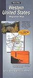
- Map features cities, states, interstates, and US highways
- insets of San Francisco, CA; Los Angeles, CA; San Diego, CA; Las Vegas, NV; and Phoenix, AZ. The Northwestern United States map in on the reverse, with insets of Seattle, WA; Portland, OR; Salt Lake City, UT; and Denver, CO
- Cities and Cimmunities index is organized by state
Unlike a single park crossing, this route lends itself to a longer regional itinerary. Use the CDOT route map to shape the loop, then check current road information for the sections you plan to drive.
A shorter alternative: Peak to Peak Scenic and Historic Byway
If you have less time or are starting near Denver, Boulder, or Fort Collins, consider Peak to Peak instead of a longer signature trip. The Federal Highway Administration lists the byway at 55 miles and about 80 minutes of driving, with Continental Divide views and access to parks, forests, wilderness areas, and recreation sites. Federal Highway Administration Peak to Peak page.
What to check before you leave
- Road status: Check official closure and condition information close to departure, particularly for high-elevation routes where weather can change access quickly.
- Park access: For Rocky Mountain National Park, confirm current timed-entry requirements. For Glacier, check whether vehicle reservations apply to your trip.
- Vehicle fit: On Going-to-the-Sun Road, account for the 21-foot length and 8-foot width limits on the segment between Avalanche Campground and Rising Sun picnic area.
- Time at stops: Agency drive estimates generally describe driving, not a complete sightseeing schedule. Allow extra time for overlooks, walks, visitor centers, and town stops.
- Maps and live updates: A regional road map can help organize a multi-town itinerary, but it is supplementary. Use official agency sources for current closures, reservations, and road status.
For a route tied to one national park’s live conditions, consult the Rocky Mountain National Park road-status page; the park also provides a San Juan Skyway route map for planning the Colorado loop.
Quick Recap
Product prices and availability are accurate as of the date/time indicated and are subject to change. Any price and availability information displayed on Amazon at the time of purchase will apply.
Quick wins for a faster PC:
Clear out junk files and repair common Windows errorsFree Scan →Fix the driver behind crashes, sound loss and screen glitchesFind Drivers →



