Recommended Free Tools
Australia’s Coral Coast Highway is a 1,250 km journey between Perth and Exmouth, linking the Pinnacles, Kalbarri’s gorges, Shark Bay and the Ningaloo marine environment. The appeal is the contrast: long open-road stretches lead to coastal towns, red-rock country and reef experiences, including shore-accessible snorkelling. It is best treated as a trip to explore rather than a drive to rush through; the regional tourism authority recommends allowing 10–14 days one way.
What makes the Coral Coast a memorable road trip?
The route’s defining feature is how quickly its scenery and activities change. Around Cervantes, limestone formations give the landscape a distinctive start. Farther north, the route reaches coastal communities and Kalbarri’s gorges, then the Shark Bay area and Ningaloo’s red cliffs, pale beaches and turquoise water. The official regional site describes the wider destination as spanning about 1,100 km from Cervantes to Ningaloo; that is the region’s approximate extent, not the Perth-to-Exmouth highway distance.

The journey also connects two World Heritage-listed regions: Shark Bay and Ningaloo. At Ningaloo, snorkelling can be part of a self-guided beach stop rather than only a boat excursion: Tourism Western Australia describes walking from shore into the water to snorkel. Tour operators also offer reef and wildlife trips from Exmouth and Coral Bay.
These contrasts are why the route can feel like several road trips in one: geological landmarks, coastal towns, gorges, wildlife and reef access, with quieter stretches of road between them. The official route page puts it simply: “The Coral Coast Highway invites you to travel differently.”
Quick wins for a faster PC:
Fix the driver behind crashes, sound loss and screen glitchesFind Drivers →Repair Windows errors before they cause bigger problemsFix Now →Scan for outdated or missing drivers - takes under a minuteDriver Scan →#1 Best Overall

- Regularly updated
- Full-color maps
- Clearly labeled Interstate, U.S., state, and county highways
- Indications of parks, points of interest, airports, county boundaries, schools, shopping malls, downtown & vicinity maps
- Easy-to-use legend
How long does the drive take?
Australia’s Coral Coast gives the Perth-to-Exmouth route as 1,250 km and suggests 10–14 days for a one-way itinerary. That gives time to stop at major attractions and spend more than a brief visit in the region. A shorter schedule is possible, but it means choosing which areas matter most instead of treating every listed stop as essential.
Tourism Australia publishes a separate itinerary covering 2,517 km over 10 days. That figure belongs to its particular itinerary and route, not a universal measurement of the Coral Coast Highway. The difference illustrates why distance and duration should be read alongside the route and stops each itinerary includes.
Rank #2
When should you go?
There is no single best time for every traveller. Tourism Australia describes March to October as a favourable general window for weather and seasonal activities, and places wildflower season in July to September. Marine experiences follow their own seasonal patterns, so choose dates around the activity you most want and check current tour schedules before booking.
| Experience | Published planning window | What to know |
|---|---|---|
| Whale-shark tours | Mainly March–August | Sightings may sometimes extend later; a tour window is not a sighting guarantee. |
| Humpback-whale tours | July–October | Confirm current operator dates and availability. |
| Turtle tours | Year-round; mating-season tours October–March | Tour offerings and wildlife encounters vary. |
| Manta-ray tours | Year-round | Check current schedules with operators. |
These are published planning windows in Tourism Western Australia’s itinerary, not guarantees of wildlife sightings or a statement of current operator schedules. Verify dates and availability with the tour operator.
Rank #3

- PL-CN111-COB-4300-830-60D-G2
- High quality products
- Ideal quality
How to choose the right version of the trip
A full drive is not the only way to experience the region. Tourism Australia lists airports at Geraldton, Learmonth (Exmouth), Carnarvon and Shark Bay as well as Perth, and notes that visitors can fly to a local airport and hire a car to explore a smaller area. The route can be driven northbound or in reverse; Australia’s Coral Coast also describes one-way rental options.
- Have 10–14 days: Consider the one-way Perth-to-Exmouth route and allow time for stops rather than using the whole trip to cover distance.
- Have less time: Pick a regional segment based on your priorities, such as Kalbarri’s gorges, Shark Bay or Ningaloo, and investigate local flights and car hire.
- Planning around a season: Match your dates to wildflowers or the marine activity you value most, then verify the relevant tour schedule.
- Want remote detours: Distinguish the sealed main-road route from alternative unsurfaced 4WD tracks, and check access requirements for each stop.
What should drivers plan for?
The main route uses Indian Ocean Drive, Brand Highway, North West Coastal Highway and Minilya–Exmouth Road, with sealed road connections to towns including Kalbarri and Shark Bay. Official regional guidance cautions that distances between towns, attractions and roadhouses can be long, especially in the north. A map may make stops look close together, but the gaps can shape a day’s driving and the timing of meals, fuel and arrival.
Rank #4

- Easy to Read Florida Map: Part of Rand McNally's Easy to Read folded map series — generously sized type, clear road symbols and high-contrast color palette make every Interstate, U.S. highway and Florida state route quick to follow at a glance
- Statewide Florida Coverage: Every Florida region on a single sheet, with detailed inset maps of Miami, Orlando, Tampa Bay, Jacksonville and downtown vicinity maps, plus parks, airports, theme parks and major attractions
- Full Street Index & Detailed Reference: A detailed index of major Florida attractions and a full street index for navigating around the state's coastal and theme park hubs
- Authoritative Place Names: Reflects the latest naming standards from the U.S. Board on Geographic Names and the U.S. Department of the Interior — updated by Rand McNally's in-house cartographic team in Chicago
- Trusted Since 1856 — Made in the USA: Rand McNally has been the most trusted source for maps, directions and travel content for 170 years; every map is designed and printed in the United States
- Plan fuel, food and accommodation around the actual distances between stops rather than assuming frequent services.
- Build daylight driving into the schedule, particularly for longer northern stretches.
- If travelling in an electric vehicle, plan charging around known listings and confirm that each point is currently operating; listed charge points do not establish live status.
- Check current road conditions with local visitor centres before taking an unsurfaced detour or setting out for a remote attraction.
- Confirm current park access, tour schedules, accommodation and fuel availability directly with the relevant local provider.
The route guidance establishes that service gaps can be substantial, but it does not verify live station status or current road closures. Treat those as day-of-trip checks, not assumptions based on an itinerary.
Independent reader supportYour contribution helps us test, update, and keep practical guides available for everyone.Is the Coral Coast Highway worth putting on a bucket list?
For drivers who want a journey built around changing landscapes and meaningful stops, the Coral Coast has a strong case: it joins limestone formations, gorges, coastal communities and reef country in one long route, with wildlife opportunities that vary through the year. Its scale is also its main planning constraint. The experience makes the most sense when you can give it time, prepare for long service gaps and tailor the route to your interests; otherwise, a focused regional section can be a better fit than trying to cover everything.
Quick Recap
Best Value
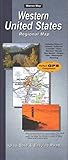
- Map features cities, states, interstates, and US highways
- insets of San Francisco, CA; Los Angeles, CA; San Diego, CA; Las Vegas, NV; and Phoenix, AZ. The Northwestern United States map in on the reverse, with insets of Seattle, WA; Portland, OR; Salt Lake City, UT; and Denver, CO
- Cities and Cimmunities index is organized by state
Product prices and availability are accurate as of the date/time indicated and are subject to change. Any price and availability information displayed on Amazon at the time of purchase will apply.




